Argentina 2010
Mendoza to the Santa Ana Border Post, Valle Colorado - January 11, 2010
(Map "Mendoza to Valle de Colorado" illustrates route from Mendoza to Barreal & Google Earth Map "Barreal to Santa Ana" illustrates the route from Barreal to Santa Ana)
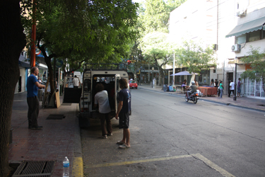
On Sunday night, we arranged to meet with Anibal the next morning at 7:45. The plan was to go over the logistics for the trip, discuss any route questions and climbing conditions and, of course, pay for the services to be rendered. Anibal and Fernando arrived right on time and Anibal, G, Bob and I headed for our room, which conveniently included a large table where we could spread out our maps and discuss the details of the trip.
 Our Google based photo "maps" proved to be as good a reference as is generally available and we discussed the routes and likely conditions that we would find. The most significant discussion point was the presence of penitentes, which have the ability to grind one's progress to a halt in the event a penitente riddled snowfield must be crossed. The result of our discussion was that Anibal did not expect we would have any penitente issues on Ramada, other than melting them as a source of water at a higher camp. In fact, water was the main discussion point as we determined that our higher camp selection would be driven less by our daily climbing goal and more by the availability of water at any given camp. We discussed the various routes, the temperatures we expected Our Google based photo "maps" proved to be as good a reference as is generally available and we discussed the routes and likely conditions that we would find. The most significant discussion point was the presence of penitentes, which have the ability to grind one's progress to a halt in the event a penitente riddled snowfield must be crossed. The result of our discussion was that Anibal did not expect we would have any penitente issues on Ramada, other than melting them as a source of water at a higher camp. In fact, water was the main discussion point as we determined that our higher camp selection would be driven less by our daily climbing goal and more by the availability of water at any given camp. We discussed the various routes, the temperatures we expected 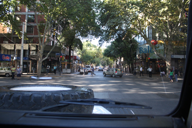 to encounter, the plan for Celeste to manage the base camp and for Manuel to climb with us to higher camps. We also confirmed that we would proceed from the Santa Ana border post to an intermediate camp that was about a three (3) hour hike up the Valle de Colorado later that afternoon. Finally, we paid the tab for the logistics and were on our way to the Valle de Colorado. to encounter, the plan for Celeste to manage the base camp and for Manuel to climb with us to higher camps. We also confirmed that we would proceed from the Santa Ana border post to an intermediate camp that was about a three (3) hour hike up the Valle de Colorado later that afternoon. Finally, we paid the tab for the logistics and were on our way to the Valle de Colorado.
Fernando Grajales was providing our road transport to Santa Ana so we loaded the gear into his Range Rover for the 5 to 6 hour drive to Santa Ana. We not only had our gear but also the food for the trip and other miscellaneous items that Celeste had requested earlier via satellite phone, important stuff like a bottle of Baileys. We were soon off and wending our way 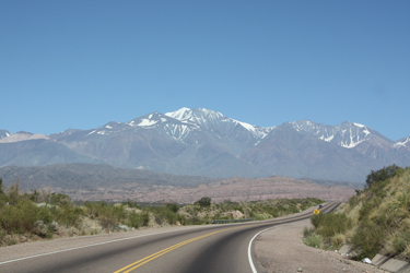 through the streets of Mendoza until we hit the highway proper and headed south out of town. We would follow the well traveled route toward Aconcagua but then at Uspallata we would head north another 80 miles or so to Barreal and then west, off the beaten path, to the gendarme post at Santa Ana. The first part of the drive was through the vineyards and semi developed area around Mendoza before we started climbing into the mountains. On the horizon we could see the mass of many mountains, including Tupingato, a rounded glacier covered peak relatively close to Mendoza. The two lane road was of good quality and is also the overland route to Santiago de Chile, at least for some of the distance toward Aconcagua. through the streets of Mendoza until we hit the highway proper and headed south out of town. We would follow the well traveled route toward Aconcagua but then at Uspallata we would head north another 80 miles or so to Barreal and then west, off the beaten path, to the gendarme post at Santa Ana. The first part of the drive was through the vineyards and semi developed area around Mendoza before we started climbing into the mountains. On the horizon we could see the mass of many mountains, including Tupingato, a rounded glacier covered peak relatively close to Mendoza. The two lane road was of good quality and is also the overland route to Santiago de Chile, at least for some of the distance toward Aconcagua.
 We soon joined with the Mendoza River, an obviously powerful and sediment laden flow coming down from the mountains. By the look of the river and the presence of rafting companies, the river would likely give a good ride, though my kayaking sense told me there was a keeper hole or two to be reckoned with by the unwary. The road tracked along the river for many miles sharing the bank with the remains of a narrow gauge railroad, whose tracks came and went as the demands of the modern highway for a right of way pulled rank over the old rail line. The road continued to climb through an area we were later told was called the windy valley, going through tunnels along the way before eventually cutting off and heading for We soon joined with the Mendoza River, an obviously powerful and sediment laden flow coming down from the mountains. By the look of the river and the presence of rafting companies, the river would likely give a good ride, though my kayaking sense told me there was a keeper hole or two to be reckoned with by the unwary. The road tracked along the river for many miles sharing the bank with the remains of a narrow gauge railroad, whose tracks came and went as the demands of the modern highway for a right of way pulled rank over the old rail line. The road continued to climb through an area we were later told was called the windy valley, going through tunnels along the way before eventually cutting off and heading for 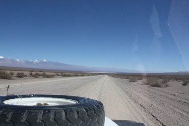 the town of Uspallata. the town of Uspallata.
Uspallata is the last shopping point before the base camps of Aconcagua and, for us, was the juncture where we would leave the paved road and head onto a mixed dirt and pavement course heading north to Barreal. We stopped in Uspallata to grab a snack, take a wiz and stretch the legs before hopping back in the Rover to hit the dirt and cover many miles to Barreal. The lay of the land, for an Estado Unidense, screams of the Basin and Range of Nevada . . . very dry and some very tough desert. We headed north and for the first half of the route Barreal the road alternated between being under construction and just being gravel, albeit three full lanes of good quality gravel. The 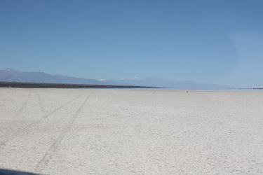 route was clearly being re-constructed with the addition of new concrete box culverts to handle the runoff that I guess, like Nevada, surelt come in the rainy season. route was clearly being re-constructed with the addition of new concrete box culverts to handle the runoff that I guess, like Nevada, surelt come in the rainy season.
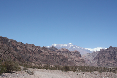
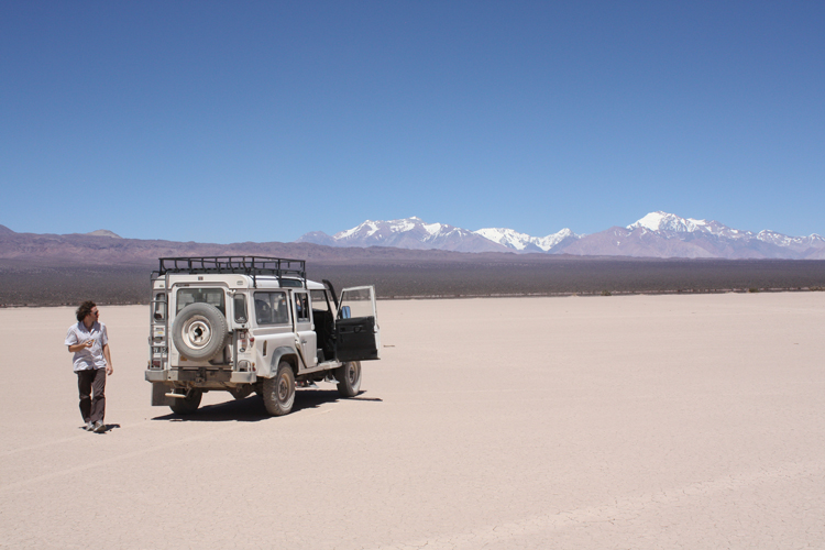
We detoured here and there for lanes under construction, but made steady progress until we left the work zone about half way to Barreal. Off in the distance we could see a range of mountains, high snow covered peaks, that Fernando identified as our destination, Mercedario and its subsidiary 6000 meter peaks . . . la Ramada, Pico de Polocos, and la Mesa. Those mountains were a long way off, a very long way off and we still had a couple of hours before we would reach the start of our hike. Once we were parallel to the southern limit of our target range, Fernando cut 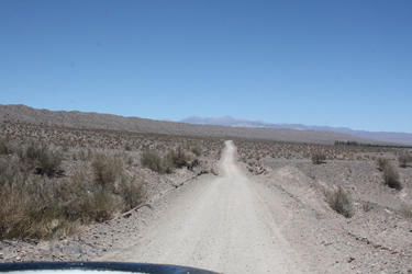 off the highway and through the desert scrub onto a two track that led to the flats of a dry lake bed. We were soon onto the lake bed itself and driving along, a constant mirage of water ahead of us, water that we would never reach. We drove to roughly the center of the bed and stopped to get out and admire the scenery, an amazingly desolate but incredibly beautiful expanse of dry sediment surrounded on all sides by desert and mountains. To the west we could clearly identify la Ramada, our target climb as well as Mercedario with its huge south snow face. off the highway and through the desert scrub onto a two track that led to the flats of a dry lake bed. We were soon onto the lake bed itself and driving along, a constant mirage of water ahead of us, water that we would never reach. We drove to roughly the center of the bed and stopped to get out and admire the scenery, an amazingly desolate but incredibly beautiful expanse of dry sediment surrounded on all sides by desert and mountains. To the west we could clearly identify la Ramada, our target climb as well as Mercedario with its huge south snow face.
 We took photos and then mounted up for a run up the remainder of the lake bed before wet cut through the brush to the highway and the last miles to the town of Barreal. We needed to make a stop in Barreal as the arriero who would provide our mule transport lived there and we needed to pick up bales of hay for the stock located in Santa Ana. We cut behind a house and within no time three or four bales of hay were hefted to the roof of the Rover and we were off again toward Santa Ana. We took photos and then mounted up for a run up the remainder of the lake bed before wet cut through the brush to the highway and the last miles to the town of Barreal. We needed to make a stop in Barreal as the arriero who would provide our mule transport lived there and we needed to pick up bales of hay for the stock located in Santa Ana. We cut behind a house and within no time three or four bales of hay were hefted to the roof of the Rover and we were off again toward Santa Ana.
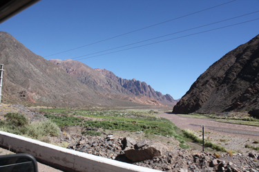
The route to Santa Ana cuts off the main road just outside Barreal and consists of a single lane dirt road, used by the Gendarmerie (border 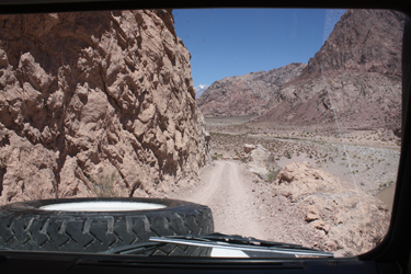 police) a mining company and climbers seeking access to the Valle de Colorado. The road tracks along a substantial river coming out of the mountains and for the most part is a pretty sedate up and down affair over small hills and through multiple draws and arroyos. But . . . there was one stretch where the river had cut a canyon through which the road also must clearly pass if access to the mountains beyond is the goal. We reached the rougher ground and the road wended its way up and through the canyon, sticking to a course cut in the southern bank and cliffs for a mile or two before gaining access to flatter ground on the other wide of the breach. police) a mining company and climbers seeking access to the Valle de Colorado. The road tracks along a substantial river coming out of the mountains and for the most part is a pretty sedate up and down affair over small hills and through multiple draws and arroyos. But . . . there was one stretch where the river had cut a canyon through which the road also must clearly pass if access to the mountains beyond is the goal. We reached the rougher ground and the road wended its way up and through the canyon, sticking to a course cut in the southern bank and cliffs for a mile or two before gaining access to flatter ground on the other wide of the breach.
 Once through he canyon, we arrived at the bridge that crossed the main river and gives access to the other bank via a classic Bailey bridge owned by the mining company. We stopped at the company's control point and signed their paperwork to allow us access and track our progress across their bridge. Fernando related that the road was public property but that the mining company owned the bridge, hence the formalities. We stretched for a bit at the checkpoint and then mounted up to drive the last few miles to the trail head. We crossed the river and drove another few miles before reaching a signed cut off denoting the access route to the Valle de Colorado. We cut Once through he canyon, we arrived at the bridge that crossed the main river and gives access to the other bank via a classic Bailey bridge owned by the mining company. We stopped at the company's control point and signed their paperwork to allow us access and track our progress across their bridge. Fernando related that the road was public property but that the mining company owned the bridge, hence the formalities. We stretched for a bit at the checkpoint and then mounted up to drive the last few miles to the trail head. We crossed the river and drove another few miles before reaching a signed cut off denoting the access route to the Valle de Colorado. We cut 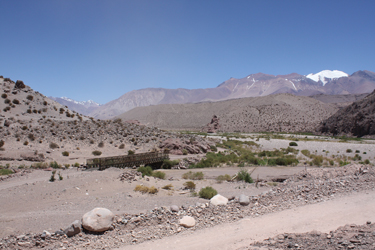 off onto the secondary track and drove another few miles over a progressively rougher double rut dirt track until we reached a ford of the Rio Colorado, the river draining the Valle de Colorado. We did not realize it at the time, but our ability to cross the river would be entirely weather and time dependent as a warm day would allow the day's melt from the alley above to course down through the Rio and make this easy ford a deep and turbulent flow that no vehicle shy of a tank could cross. off onto the secondary track and drove another few miles over a progressively rougher double rut dirt track until we reached a ford of the Rio Colorado, the river draining the Valle de Colorado. We did not realize it at the time, but our ability to cross the river would be entirely weather and time dependent as a warm day would allow the day's melt from the alley above to course down through the Rio and make this easy ford a deep and turbulent flow that no vehicle shy of a tank could cross.
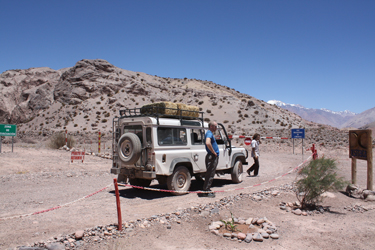
We crossed and drove the last couple of hundred yards to the clump of trees marking the gendarme post at Santa Ana. The arrieros were awaiting our arrival, perhaps more the arrival of the hay, but regardless there were mules and two gauchos ready to move gear to the mid point camp. We unloaded 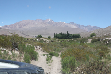 everything we would need for the next week and a half and bid farewell to Fernando who was soon on his way back across the ford and onto Barreal. The trip from Mendoza to Santa Ana took about 6 hours and was a lot of fun. Fernando took time to go out onto the lake bed and made the whole ride a pleasure. Clearly we would look no further for transport services if we return to climb again in northern Argentina and I would recommend Fernando and his service to anyone without reservation. everything we would need for the next week and a half and bid farewell to Fernando who was soon on his way back across the ford and onto Barreal. The trip from Mendoza to Santa Ana took about 6 hours and was a lot of fun. Fernando took time to go out onto the lake bed and made the whole ride a pleasure. Clearly we would look no further for transport services if we return to climb again in northern Argentina and I would recommend Fernando and his service to anyone without reservation.
|
