|
||
|---|---|---|
Holy Cross Ridge and Mt. of the Holy CrossAugust 8, 2011 - Climb from Lower Tuhare Lake
When we arrived a Lower Tuhare Lake the afternoon before we noted that there seemed to be a direct route from the lake to a spur projecting from about the half way point of Halo Ridge. Rather than climb to the end of the valley and figure out a route, it seemed easier to accept the gift horse route and take what I anticipated would be a more gentle ascent along the ridge top. The alarm was set for 4:30 and when it went off, I fired up the stove for some hot cereal. That is the advantage of a non floor minimal tent like the 'Mid . . . just fire up the stove from the comfort of the sleeping bag.
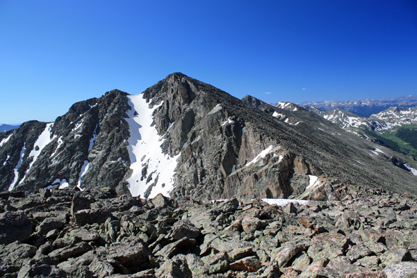
The summit of HCR is not the typical rounded summit but is really just one of a series of pointy blocky highpoints along the length of Holy Cross Ridge. Nothing spectacular but a summit nonetheless and another Centennial in my unofficial quest to complete the hundred highest summits of Colorado. We stopped for all of about one minute and then headed down the back side to connect via the ridge to Holy Cross proper. The We arrived at the low point of the saddle and looked up the ridge to Holy Cross, about 500 vertical feet above us. The route is a combination of two steep sections of talus with a tamer mid point stretch of lesser rock and milder angle. The route offered an obvious climber's track, We took in the route back down Halo ridge from HCR and I considered the thought of a direct descent to the upper Tuhare Lake. But, I rarely descend something is did not climb and I figured there was just enough of a chance that we'd
At this point, we were both tired but looking at no more than a two mile road march, the majority of which was downhill. Sure the road has an up pitch here and there but thos short ups really don't matter when you know that the car equates to the Tevas instead of the approach shoes and pizza down the road in lieu of another power bar. We covered the last segment at a brisk pace and arrived at the car at 6:15, making for just shy of 12 hours of almost non stop hiking and climbing. All in all, the closure of the Tigiwon Road was a gift, a gift of a new valley, a gift of a nice overnight at a remote lake and the gift of a longer distance running off the Cottoneers that otherwise mob the route to Holy Cross. An overall excellent route.
|

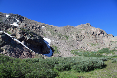 We left camp at about 6 a.m. and headed uphill, skirting the small lake that lies atop the bench we camped below. The route to the ridge was a mix of grass slopes and talus climbing that offered sedate Z shaped course up the flank of the ridge. I would guess that we spent 30 to 45 minutes gaining the sub-saddle on the ridge, which rather than offering relief from talus hopping turned out to be large talus and boulder pile that led up to the Halo Ridge proper. We arrived at the juncture and found ourselves at about the center point of Halo Ridge. We topped the point and could see back to Notch Mountain and forward to both Holy Cross Ridge and the Mt. of the Holy Cross proper.
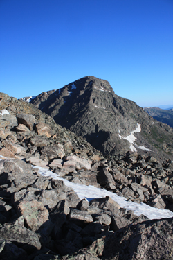 We dropped down the far side of this first point and found what I'd hoped for, a stretch of flat ridge that would give us a fair stretch of non boulder hopping. The ridge pinched briefly but then opened wide before leading to the next up-spike, another mass of boulders that we had to climb up and over. Once atop this pile, we saw that we needed only to climb one more boulder pile, the top of which was the Centennial Holy Cross Ridge ("HCR"). This last pile however had a bit of a climber's trail leading to the top, making the final pitch a bit easier but still a game of boulders and talus.
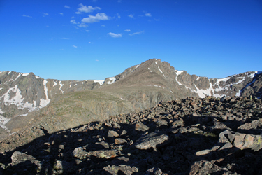 route down has a trail segment or two but due to the large size of the boulders, it is a hop from here to there with the ever present reminder to be careful as a slip will likely get one a set of sutures or broken leg as a reward. We found that the best route was slightly away from the edge of the ridge as the ridge line is scalloped and a descent on the edge proper brings one to gouges in the ridge that must be worked around.
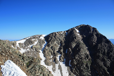 which we generally followed to the summit. Our crossing from HCR to Holy Cross took just a minute or two under an hour to complete. We'd summitted HCR at 8:30 and now we were atop Holy Cross at 9:30 . . . we had only to safely descend and hike back to the car with 1000 feet of climb up in the process. The day was however textbook bluebird so off we went (not that we had a choice). Our retreat back to HCR retraced out route over and took less time as we were feeling good and we only had to gain 350 feet or so to regain HCR from the mid peak saddle.
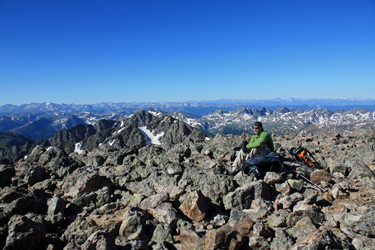 end up having to de-cliff ourselves as we worked our way down through the upper valley. No, we would retreat down our route of ascent. We skirted the first hump we came to, took pleasure in the intermediate flat area and then again skirted the intro hump to arrive at the top of the route we climbed up from the lower lake. More rock hopping but with patience we both made the safe descent of about 1000 feet to arrive back at the 'Mid where we planned to stop for lunch. All in all, it took us a full 3 hours to drop from Holy Cross, landing us at the tent at 12:30.
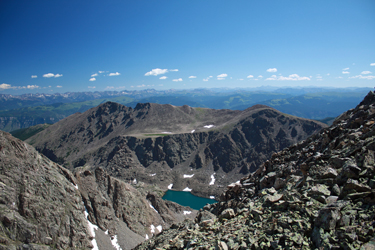 I had carried all of our food waste and trash up the peaks and now back down again to ensure that the marmots could not get into any of it. They had left the tent and sleeping gear that was stashed under it alone. I packed the 'Mid and the rest of the gear, as did Bob, and then we took about a half hour for lunch. Then we were on the trail to the car but not really looking forward to the hike over Fall Pass. First, we lost 500 feet getting back down from the Lower Tuhare shelf and across the creek at the bottom . . . the next task was to get back over Fall Pass in the afternoon heat. It was not that hot but after 12 Wyoming winters (read 8 months out of every 12) I just take a beating when the temp is over 70 and the sun is further heating me up. I grouse about the cold in Wyoming but reality is I wouldn't last a day of an Arizona summer.
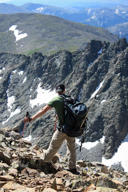 I took the lead and we powered up 3/4 of the distance and all but about 200 of the vertical needed to cross the pass, a non stop rest stepping hump. We took a breather and then powered the last fourth to the summit, getting our feet wet during the course of the stream crossing and the bog above that. How you can have a bog on the side of a hill I do not know but this was one of those hills where the ground is wet from a continuous flow down from snow fields above. We stopped at the pass and made a late offering to Pachamama
 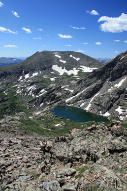 and then headed on down. The course down valley went quickly with our next stop literally being the juncture of the Holy Cross Jeep Trail and the top of the aqueduct road . . . we could both smell the barn, hence a non stop four mile segment between the pass and jeep trail.