-
Mt. Bierstadt Group Summit - Front Range, Colorado
-
A rest before the summit push on Dallas Peak - San Juan Range, Colorado
-
Broken Ankle + 6 Miles = Tired
-
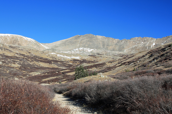
The classic San Juan approach - San Juan Range, Colorado
-
Overlooking Noname Basin from Twin Thumbs Pass - San Juan Range, Colorado
-
Upper Noname Basin - San Juan Range, Colorado
-
Nearing Noname Cabin - San Juan Range, Colorado
-
Twin Thumbs Twins - San Juan Range, Colorado
-
Nearing the summit of Pt. 13,736 - Sawatch Range, Colorado
-
Blustery day on Iowa Peak - Sawatch Range, Colorado
-
Morning snow at 15k, Cerro Ramada - Cordillera Ramada
-
Artesonraju from the summit of Nevado Pisco - Cordillera Blanca, Peru
-
February crowds on Gray's Peak - Front Range, Colorado
-
Kicking steps on Cerro Lliani - Cordillera Vilcanota, Peru
-
Final traverse to the summit of Wheeler Mountain - Ten Mile Range, Colorado
-
The long walk to Pachanta - Cordillera Vilcanota, Peru
- banner31
Afternoon at 17k on Cerro Ramada - Cordillera Ramada, Argentina
- banner22
The final ridge on Iowa Peak - Sawatch Range, Colorado
-
Summer summit on Longs Peak - Front Range, Colorado
-
A rest day at the Pachanta Hot Springs - Cordillera Vilcanota, Peru
-
Mind over matter on Mt. Parnassas - Front Range, Colorado
-
Rest stop on Cerro Lliani - Cordillera Vilcanota, Peru
- banner30
Post nap surprise on Cerro Ramada - Cordiller Ramada, Argentina
-
Summit on Cerro Lliani - Cordillera Vilcanota, Peru
- banner23
Ridge walking on Grizzly Peak - Sawatch Range, Colorado
-
Enroute the summit via the West Ridge on Pacific Peak - Ten Mile Range, Colorado
-
Mule train bound for Chilca - Cordillera Vilcanota, Peru
-
Taking in the view from Fletcher Peak - Ten Mile Range, Colorado
-
Hiking on Silverheels - Mosquito Range, Colorado
-
Traversing! Gladstone Peak - San Juan Range, Colorado
- banner24
The best of times at Willow Lake - Sangre de Christo Range, Colorado
- banner29
High Altitude Cerebral Edema? - Cordillera Ramada, Argentina
-
Bound for Chilca - Vilcanota Range, Peru
-
Going alpine light, Holy Cross Ridge - Sawatch Range, Colorado
-
Cumbre! Campa I - Cordillera Vilcanota, Peru
-
Roadside lunch with the best of company - Cordillera Vilcanota, Peru
- banner25
Long ridge walk to the summit of California Peak - Sangre de Christo Range, Colorado
- banner28
Crossing el Rio Colorado . . . in the afternoon - Cordillera Ramada, Argentina
- banner37
Dealing with Fall snows high on Casco Peak - Sawatch Range, Colorado
-
Moonrise over Mercedario - Cordillera Ramada, Argentina
-
Still climbing at 20,900 on Cerro Ramada - Cordiller Ramada, Argentina
-
Talus on Halo Ridge, Mt. of the Holy Cross - Sawatch Range, Colorado
- banner26
Deteriorating conditions on Mt. Arkansas - Ten Mile Range, Colorado
- banner27
After the climb - Cordillera Ramada, Argentina
- banner38
Taking in the view from the summit of Crystal Peak - Tenmile Range, Colorado
-
Topping out on Mt. Arkansas' North Couloir - Mosquito Range, Colorado
-
Glissade on Mt. Arkansas - Mosquito Range, Colorado
-
Hard snow morning on Teakettle Mountain - San Juan Range, Colorado
-
Spring snow announces the start of the climb on Dallas Peak - San Juan Range, Colorado
-
Crossing the Eolus Catwalk - San Juan Range, Colorado

 We followed our Fall standard operating procedure where there is little risk of afternoon storms and the scope of the climb really amounted to eight hours or less on the mountain . . . a 5 a.m. departure. We picked Ed up in Thornton and were at the parking spot on the Mosquito Pass Road by abut 8:30. I'd expected wind, perhaps a good bit of it, but we gathered our gear in still air and left the truck wondering when the winds would arrive. Of course, none of us voiced that thought, knowing that in doing so we would extend the welcome mat to the winds for sure.
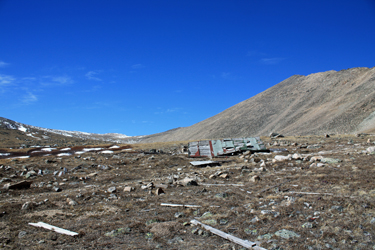 I knew that most of the route would be on an old mining road, followed by a cut across a more gradual section before the ridge climb to the summit of Mount Tweto proper. Ed and Bob would split off at some point that would allow them to climb the flank of Buckskin, where they would encounter some Class 3 terrain as compared to the class 1 route I picked for the day. I was still babying the ankle, figuring to get out and work it but I was no quite ready for an stretch of class 3 ground. We followed the dirt road for a ways then cut cross country to take amore direct route to the flats from which we would go our separate directions.
 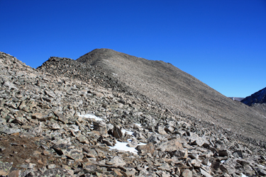 We stuck together to a point just past the summit of Buckskin to where the old mine road takes an obvious run at the flank of the connecting ridge. Ed and Bob cut off to climb scree and rock and I went my own way up the valley toward the saddle that grants easy access to the ridge connecting Tweto with Treasurevault Mountain. The walk was tame the whole way and upon reaching the ridge, I cut upward, encountering class 2 terrain here and there but just barely class 2 if one is quite generous in assigning difficulty. The ridge consisted of two more steeply sloped sections and then a final walk to the summit proper. A trail segment was had here and there, leaving no doubt to a doubtless route.
 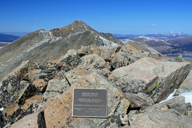 I scored the summit at just about the same time as a call came across the radio from Bob that they were now on the summit of Buckskin. Given the distance of over a mile, I could just pick out two figures on the far away point but little else. I noted the Tweto plaque and then after having a bite to eat, left a single bear as an offering to Pachamama (I know first hand the consequences of forgetting to do so) and headed down. In the meantime, Bob and Ed wandered down ridge to the summit of Loveland Mountain and then they too started down. I simply reversed my course, and except for stopping to scope out the cable tramway rigging at some mine ruins, made quick time to the truck. Bob and Ed arrived no more than 5 minutes later and we headed for a burger in Fairplay after a solid 5:30 or so round trip for both parties.