|
||||||||
|---|---|---|---|---|---|---|---|---|
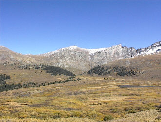
Mount SpaldingSeptember 22, 2002 - West Ridge
Gary and I originally planned to climb Mount Bierstadt via the Sawtooth ridge, approaching from the flank of Mount Spalding. Gary had not been across the ridge and since we had both been up Bierstadt’s West Ridge route twice, we chose to attempt a crossing in the opposite direction.
We took the standard route down from the car park, which had more than a few cars by the time we arrived at 9 a.m. The trail across the willows is now an elevated highway in some sections and we quickly hiked to the stream crossing from which we would head up Scott Gomer creek toward the flank of Gray Wolf Mountain. We crossed a boggy section, sticking to reasonably dry ground and aimed for solid ground as soon as possible. Now it was time to climb and we went up through the trees to intersect a trail leading to a break in the minor headwall, the Dawson course as shown in the 14’er guide. We crossed the drainage between Gray Wolf and Spalding and then hiked up the grassy slopes, sticking to trail segments where found, some patches of hard packed snow, and more than a few rocks to connect the two.
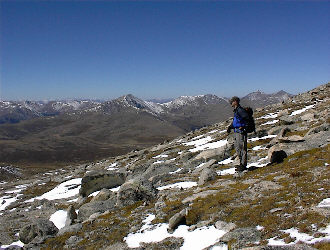
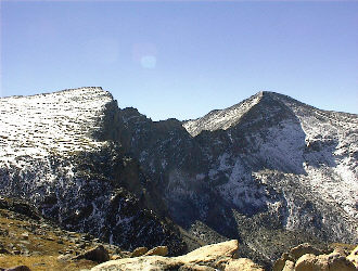
Once we arrived at a point where we could scope out the Sawtooth, we found that we really did not want to tangle with the shaded and downward sloping section that one must cross to reach the gendarmes. I crossed the ridge years before and remembered that one section as an area I would not want to traverse on snow without an ice axe and crampons. Realizing that discretion was the name of this game, we looked toward the top of Spalding and headed up to its rounded summit. Gary had bagged Evans from Summit Lake years before therefore Spalding was nothing new to him but my Evans climb had been via Bierstadt and the Sawtooth, therefore I was going to score a high 13’er in exchange for our half day effort.
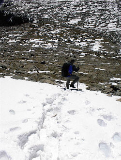
We ate a snack on the summit, sitting behind a boulder that effectively blocked the wind, which seemed to have become noticeably colder over just the last few minutes. Sooner than later, the packs went back on and we strolled down the long slopes of Spalding to the drainage far below, onto the obvious trail atop the short headwall and down into the willows. The willows were dry and we made our way through them on decent trail until just about the end when the route braided like mad and we settled for the most traveled path to the parking area. The climb took us just over 5 hours and though we did not score the ridge, we did get out and warm up the high country legs for the first time in over a month.
|
