|
|---|
Mount YaleAugust 11, 1988 - Avalanche Gulch
Nevertheless, we kept walking the ridge, with its steady climb and occaisional steps here and there until we reached the summit. As we topped out, we noticed the approach of an electrical storm from the west, with the steady report of thunder giving us fair warning that it was time to make for a lower elevation. We knew enough to know that the ridge that lead us to the summit was a long path at elevation and that the storm would be on us well before we made it to the drop off from the saddle. Instead we took a diagonal route to the head of Avalanche Gulch and then followed that We still managed to get a good soaking on the way down but no close lightning strikes to raise the hair on our hands or make that single snap link sing St. Elmo's song. We walked back to the camp spot and broke camp, having bagged our third 14'er in about 36 hours. What we'd lost to the lack of oxygen at 14k came back by the time we reached the campsite and we were off to the summer trailhead for a Grays and Torreys combination the next day. We might have come as Cottoneers but now we where morphed into peak bagging Cottoneers.
In hindsight, just four days in Colorado seems like too a fast trip, but such was not the case. Neither of us had climbed a 14’er in five years and it was worth it. To this day, I have Colorado locals ask incredulously if I drove “all the way” down from Cheyenne to climb for the day, and I answer yes. I know that if they compared that extra 90 minutes from Cheyenne to a 1600-mile plane ride (or worse yet a 5 year drought), their appreciation of their backyard bounty would jump up a notch or two.
|

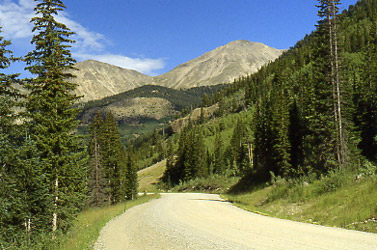 Two days before this climb I was totally acclimatized for sea level and one day before, Dan and I had climbed both Tabaguache and Shavano without any problem. Mt. Yale, however, would be a lesson in the effectof altitude on the body of a Cottoneer. Following our previous day's climb, we shifted camp from Angel of Shavano campground to the Collegiate Peaks campground, on the road to Cottonwood Pass. We'd had a good meal in Buena Vista and shifted our meagre camp to be ready for an early morning departure for our next 14'er.
 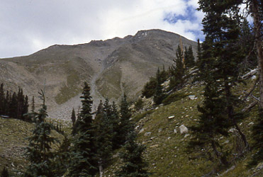 We left the campground at first light and climbed steadily up the obvious trail at first and later up endless scree to the saddle separating Yale from its sub peak. In today's guide books, it says that the trail to the saddle is the easy to see and follow Colorado Trail but when we climbed, I just do not remember a clear and obvious path to follow. I do not recall our exact path but it was likely on the proper route, though I recall more scree than trail. However, the toll exacted by the previous day’s score, became evident at the saddle when just figuring out which way was up became a bit of a challenge. The fatigue and altitude hit us and hit us hard as we struggled to make the final push to the summit of Yale. It is a long ridge
 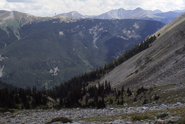 walk to the summit and I recall feeling what I would later come to know as the sure signs of hypoxia later in my climbing career.
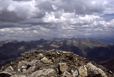 course down until we intercepted the established trail much lower and closer to the trail head.
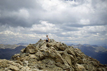 We drove the two hours or so to the Stevens Gulch trailhead and set our tent in the rocky parking lot, which at the time had just a car or two. The night turned cold and by the time we settled into the sleeping bags, there were no stars to be seen. The alarm the next morning did not bring the promise of a sunny day during which we would gain two more summits, but instead a low rolling mist and skud of cloud just a few hundred feet above our camp. We were pre-Gore-Tex and our idea of rain gear was getting in the car before the Carhart pile sweatshirts got totally soaked through. We knew we had no business trying to score two summits in this weather and instead went to nearby Georgetown to play tourist and, later in
 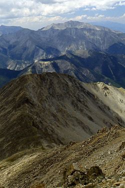 the afternoon, ridge the Georgetown Loop steam railroad as a fitting end to the trip.