|
||||||||||||||||||||
|---|---|---|---|---|---|---|---|---|---|---|---|---|---|---|---|---|---|---|---|---|
Australia
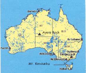
During a trip to Australia in 1994, Debbie and I were able to include two short but still interesting climbs in our itinerary, Mount Kosciusko and Ayers Rock or Ularu. The pull of Kosciusko was simple, it is the highest point on that incredible continent, one of the “seven summits” and a day hike in beautiful alpine terrain. Ayers Rock on the other hand takes a bit more effort to reach, is a short climb, and just getting there gave us the opportunity to experience the Australian outback. Mount Kosciusko, February 1994Charlotte Pass Route
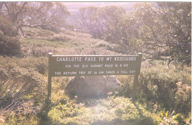
Debbie and I reached the Victorian Alps after being in Australia for about five days. We spent our first couple of days in Sydney, checking out the sights, and then we took the great plunge, we picked up the rental car. Not wanting to do things halfway, I picked the car up from the Hertz lot just on the edge of Kings Cross, a seriously busy part of town. The time was . . . rush hour. I am still able to write this so we did survive but for those who have never driven on the opposite side of the road, it was an adventure. We survived the Sydney traffic and made a beeline for more open country roads. We spent the night near Canberra and then went to Jindabine, the closest small town to the area park containing Kosciusko. We stopped at a park information office, got the standard be careful speech and then went on up to the trailhead, at the end of a dirt road above the Perisher Valley and Charlotte Pass ski areas.
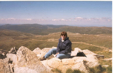
We did not know much about the climb other than it was a ten mile round trip road march that would take us across some of Australia’s beautiful but limited alpine terrain to the continent’s highest point. The altitude at the top is a modest 7,241 feet but the tundra stands in stark contrast to the climactic zones that typify the rest of the country. For me, Australia is synonymous with narrow wet coast zones and inland red deserts known for their inhospitable nature. Kosciusko however is located in the Great Dividing Range, a mountain range along the southeastern coast. The climb or more appropriately described road march to the summit of Kosciusko was a pleasurable walk for us, a touch of a chill from a breeze but mostly sunny and at an easy going grade. We had packed water, lunch, and an extra layer and were well set for the walk.
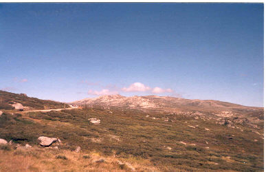
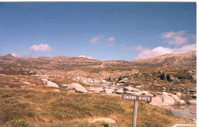
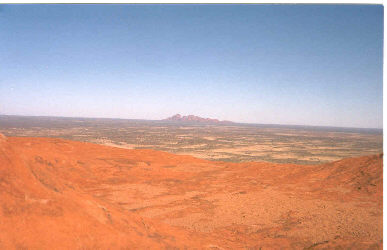
The walk begins in stunted brush and winds along the flanks of various knobs until you start getting the idea that the high ground in the distance is the summit. The vegetation grows smaller and turns to tundra as you continue to leisurely hike on the road, finally coming to the base of a final short path to the summit proper. The views along the way cover the expanse of these modest rolling mountains and other less visited, peaks are seen across the high valleys. The summit proper is a rounded knob and soon enough we were there, standing atop Australia’s highest mountain. There were a few other folks around but no crowd by any means and after a bite to eat; we started the walk back down the road to the car. We crossed the spring where Australia’s storied Snowy River begins its course to the sea. We got back to the car in mid afternoon and Debbie was pooped. We found a campsite near Jindabyne and some good food before heading onto the Victorian goldfields, northwest of Melbourne, the following day.
Should you ever be in the area, make a day for Kosciusko, its a beautiful walk through an unspoiled high country. Of course, you may not feel that it is one of the seven summits but put that aside and enjoy it as a respite from some of Australia’s other natural wonders, the heat and endless supply of flies! Ayers Rock or Ularu, February 1994Tourist Track
After climbing Kosciusko, we made stops in Melbourne and Perth before flying back across the continent to the Cannes in Far North Queensland. If you look at the map, a stop at Ayers Rock looks convenient and the airlines certainly agree with that analysis. Our flight to Cannes on Ansett Australia had an optional stop in Yulara, the airport near the rock, so we ticketed our travel to allow a two-day layover at Ayer’s Rock. We figured this would give us time to not only see the incredible colors of the sunset on the rock but an opportunity to climb to the top as well. Our flight arrived at about one in the afternoon and we rented a small car (two place riding lawnmower?) to get to the resort area near to the rock. The car was probably not necessary but we had visions of going out to the Olgas and wanting to pick our own time to go to and from the rock. We were camping out, so our first stop was the campground at the edge of the resort area. I say resort area with some trepidation but there is a four star hotel at the Yulara that cater’s to the non-camping guest’s needs. Our accommodations were a bit more sparse; a bare spot on the ground among many other tents but the campground did have a very welcome pool for cooling off in the afternoon.
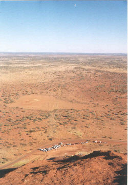
After setting camp, we drove to the Rock and scoped out the trailhead and visitor center. We were also curious about the trail that leads around the base of the rock and started off on it for a bit but turned back relatively soon due to the flies. For readers who have never been to the outback, it may appear to be much like our American southwest, red, hot, the usual desert gig. However, once you have been there, it takes on a completely new meaning . . . flies. Flies around your head, in your ears, up your nose, in your eyes, just watch an outdoor special about the outback and you will see the over developed arm muscles of anyone who has been there for a while, they constantly wave off the flies. I guess the residents get used to them but by the time we covered the first mile of the perimeter hike, we had both had enough. We turned and headed back to the campground for a cool dip in the pool.
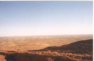
That evening we were treated to the incredible sunset colors that the Rock that is known for. Ayers Rock is visible from the campground but we wanted a clear view, so we hiked to a nearby lookout point on higher ground to take in the show. After sunset, we shifted our attention to dinner and made for the Australian Barbeque, also located on the resort loop road. This is a neat operation; you pick your menu item, ranging from beef to camel (my choice) and receive a slab of raw meat on a plate. You take the plate to the grill and cook it to your personal taste. Grab some veggies from the next grill over, buy a brew, and make for one of the picnic tables for dinner. What about the flies? “No worry” they only work the day shift, the mosquitoes make up the night crew! Dinner was great and afterward, we walked back to the tent and settled in for the night. We wanted to get up early the next day and start our climb before the heat of the day came on.
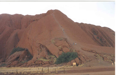
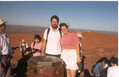
The next morning, we were up just before sunrise and headed for the Rock. We parked in the car park and I grabbed my daypack with an extra layer, sunscreen, and lots of water. The climb up the rock is about a two hour round trip, the first part of which is very steep and the second part, a traverse across the ridged top of the rock. The first part is steep, very steep, and climbers hold onto a chain mounted on posts for much of the first section of the climb. The rock is worn smooth from the traffic and a slip will have obvious consequences, most likely fatal. In fact, there was a sign at the bottom noting that two climbers had fallen during the past year and that anyone fearful of heights or weak of heart should reconsider now. We made the steep pitch without a problem and then traversed across the top of the rock. The top is ridged from the erosive force of the prevailing winds and we climbed up the ridges and down into the adjoining furrows, up and down, until we got to the highest point, marked by a graffiti covered monument.
Unlike Kosciusko, there was a crowd at the top as the Rock is a stop on the Japanese tour bus circuit. We found a gap in their ranks and were able to get one of them (no shortage of qualified camera operators) to snap a quick photo of us on top before we headed on back to the chain descent and waiting car. The descent required for care but soon enough we were back at the base and again contemplating a circumnavigation of the Rock. We thought about it hard as we brought our head netting but the flies again won out and we decided to head for the camp instead. We stayed in the shade during the hottest part of the afternoon and later headed to a coffee shop in the more affluent part of the resort loop for dinner. After dinner, we took in a concert by a local band featuring lots of didgeridoo playing and stories covering Aboriginal and local lore. We had a good time and by the time the show was over, we were more than ready for the tent. We flew on to Cannes the next morning, having climbed the rock, eaten camel steak, swatted flies, and taken in the legendary red sunset of Ayers Rock. In hindsight, Ayers Rock is a long way from anywhere and the omnipresent flies and heat were oppressive (we came from a cold winter) and I will not likely return for a second visit. I would not have missed the first visit if I had been given the educated choice and but perhaps it is most aptly described as one of those things you might just do, if for no other reason than to make the claim of having done so later.
|
