|
||
|---|---|---|
Phoenix PeakJuly 20, 2012 - West Willow Creek
I made a good hearted effort to climb Phoenix Peak two weeks prior, including a drive all the way from Cheyenne to Creede, only to find Creede being dumped on when we arrived. I just did not have the heart to set up the tent in a downpour, so I pulled the plug and found a USFS campground about 15 miles distant that happened to not be getting dumped on. The next day my wife and I played tourist including taking a look at the start of the Willow Creek 4WD road, but climbing Phoenix that weekend was just not in the cards.
I descended the short slope and worked my way to the far side of the creek, managing to drop a foot fully into the water along the way. Just a quick doofuss move but enough for a total soak and a stop to wring out the wool sock. The route from there was obvious as the trail entered a side drainage and went for about 1/2 mile before turning back in the direction of the peak and proceeding up an un-named creek.
The meadow climbed perhaps a bit more than 100 more vertical feet before I gained a sight line to the start of the climb to the summit proper. I spotted a serpentine ridge The ridge provided more of the same, an easy going class 1 hike to the summit. The summit was marked by a well constructed and quite tall beehive cairn, leaving me no doubt that I had picked the right hump to call Phoenix Peak. I took the requisite photos and sent a summit photo to my climbing partner, at work. Not exactly fair but I knew that someone now had a progress report as to my being down bound rather than simply climbing Phoenix Peak,
|

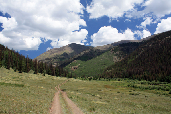
 Two weekends passed and the prospect of practicing law for five consecutive days in the middle of what is really an all too short summer for us Wyoming residents just did not make sense. I packed the Toyota with the gear and headed for Creede on Thursday afternoon. I camped at a commando site just 100 yards up the Willow Creek 4WD road, a site that I spotted on the prior trip when I walked the first quarter mile of the road to see if the rest was as rough as the first 100 yards. (it wasn't) I had the tent up in no time and set the alarm for 4:30, knowing that the monsoon was full on and that I was planning to walk the 4WD road, making for a full 11 mile day.
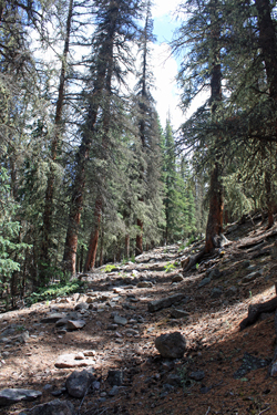 The alarm went off and was promptly reset for one half hour later. It took the 5 am ring tone more seriously and was outbound from camp at about 5:20, first light of the day. I descended the hairpin turn and made good time all the way to the cut off a bit beyond the crossing of Whited Creek. The road was a fast easy walk that made a perfect start for what turned out to be a perfect sunny day. I found the point where one cuts off the road to the right having gone the requisite distance and by spotting a marker pole and the remains of a road that cut down the hillside and crossed to the other side of Willow Creek.
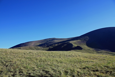 The trail descriptions tell of crossing to the south side of the un-named creek but also tell of not doing so too soon. I'd read many a trip narrative about crossing too soon, so of course, I crossed too soon. What caught my attention was this trail running straight uphill on the other side at an obvious crossing point. After crossing and climbing uphill for about 100 feet of vertical, I knew I had taken the bait. I dropped back to the stream and side hilled upstream, seeing signs of others doing the same, and then after about 1/4 mile
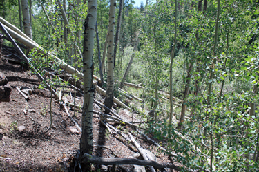
 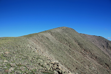 The creek at this point is beaver city, with multiple ponds that make an easy re-cross without a drop to the original crossing point difficult. Hence like so many others, I chose to force passage on the wrong side. I soon intercepted the trail as it crossed the creek, nicely marked by cairns on both sides. Once back on trail proper, I came to the old Center Stock Driveway and followed it to tree line. I had no idea what a "driveway" was but assumed it was a road to drive stock over or through the mountains. A little post climb reaserch told me that it was a route by which cattle and/or sheep were driven to the high country for summer grazing. The driveway did not turn out to be a wide open cut or if it once
 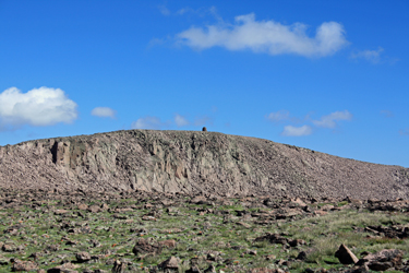 was, it is growing in right nicely. The trail was pretty easy to follow, through sparse here and there, and it was well marked by cairns, not too many, but enough to boost confidence if one loses the track. The driveway climbed steadily and after a mile and a half, I came to tree line right at about the same time as one sees a short rocky cliff line on the far side of the creek. I cut across the creek and climbed through the meadow, knowing from the map which of the high green humps was the summit I was aiming for.
 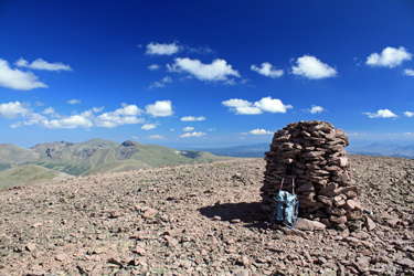 dropping from the saddle between Phoenix and Pt 13,780 and from a distance could see a use trail snaking along the lowest portion of the ridge. I crossed the upper reaches of the meadow and took to the trail. The trail was solid for a few hundred feet of vertical and then fell away to segments from that point to the saddle proper. I opted to climb to the saddle proper in lieu of sidehilling, figuring to hike the ridge to the summit proper.
 solo. The skies were still quite clear but sticking to summer climbing rules, it was 10:25 and I was soon to be headed down. I re-traced my ascent route and crossed the creek at the correct point. My reward was a trip through beaver land, which I negotiated by staying high, high enough that the rodents gave up climbing to cut more aspen. I hit the truck at about 1 pm . . . next stop was Creede for some lunch before heading the Thirty Mile Campground for the next day's shot at