|
||||||||||||||||
|---|---|---|---|---|---|---|---|---|---|---|---|---|---|---|---|---|
Wilson PeakSouthwest Ridge &July 5, 2002 & August 20, 2011
July 5, 2002
We originally planned a trip on the Durango and Silverton to climb the three Weminuche peaks but the arrival of the Missionary Ridge fire and continued dry conditions brought that plan to a dead halt. The railroad was still running through the Animas Canyon to some extent but not letting hikers off at the Needleton stop, our gateway to Needle Creek and the peaks located in its headwater basin. Rather than not climb, we implemented the back-up plan and again watched the progress of another fire, which thankfully was controlled before causing significant restrictions in the portion of the Uncompahgre and San Juan National Forests that include the San Miguel peaks, a.k.a. the “Wilsons.”
We took off from Cheyenne on Friday after the 4th of July and headed for Telluride and the Silver Pick Basin. We had heard just before our departure that the Eco-Challenge would be staged out of Telluride and we hoped that we would not be sharing the Wilsons with either the participants or the media/groupie putzes that undoubtably accompany such an event. We made the long drive and decided to challenge the possibility of an Eco-head encampment by going directly to the Silverpick trailhead to see if a camp site was available. Fortunately, we found a spot (sans Eco-heads) and though the trailhead was a bit crowded with vehicles, and we soon had the tent up and a plan in place for the next day. Before then however, we had an invite to dine with a friend of Gary’s in Rico, about 25 miles south of Telluride. We had a fine dinner of lasagna and salads; the food was great, the beer cold and if you have never been to Rico, scope it out. A Colorado back road gem for sure.
The next morning we awoke at 4:15 and planned to be on the trail for Wilson Peak by five. In the back of our minds, we were nurturing the thought of a Wilsons triple play but, as the day went on, the clouds built, and the reality of actually pulling off such a climbing stunt sank in. We realized we would get Wilson Peak alone, the others would have to wait. The Silverpick road is gated at the park/camp area and it is about 3.5 miles to the Rock of Ages saddle, on the flank of Wilson Peak. The first mile or so is in the trees and then the old Silverpick mill site is reached. We passed the mill site, and a few backpacker’s tents, just before dawn and kept trudging on up that road.
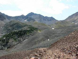
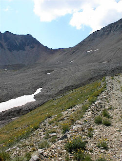
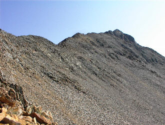
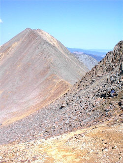
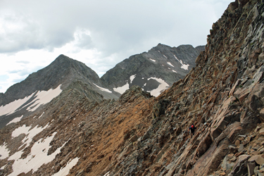
After dawn, we stashed our headlamps and kept on walking. The trail just climbs and climbs, from about 10,500 feet at the start to 13,000 at the saddle and the trip to the Rock of Ages saddle took us just over two hours. Most of the road was in good shape, as in I’d be able to get my truck up it, but after the old stone bunkhouse, we crossed a small snowfield and onto the portion of the road blocked here and there by rock slides. The overall route was obvious and the trail deposited us right on the saddle with but a small touch of scree on a switchback here and there. From the saddle, we headed along solid trail traversing the mountain’s flank to the next saddle, on the ridge joining Wilson Peak and adjacent Gladstone Peak, again on solid walking trail. However, beyond the second saddle, the trail became a scramble/trail segment combination as it steadily progressed up the flank of the peak.
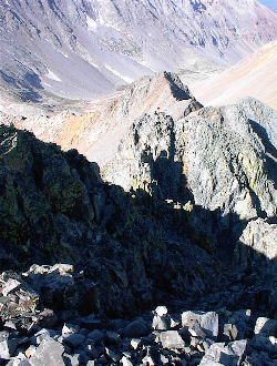
It took us about an hour to reach a point just below the summit where the crux of the climb requires a descent into the upper reaches of a narrow and ledgy couloir before heading up for the summit. I’d guess the climbing is class 3 but I would not want a mis-step through this stretch. The climb out of the couloir was on good rock and once atop the pitch, we simply walked upslope to the summit.
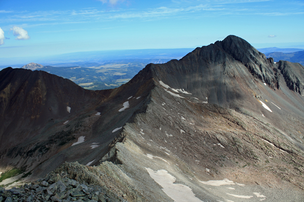
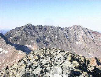
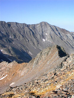
From the top, we looked out on Sneffels, the Wetterhorn and Uncompahgre, and of course, Mt. Wilson and El Diente. The idea of a triple play faded to a vague memory by this point as the ridge connecting these two peaks appeared to be a challenge even from the dsummit of Wilson Peak. In addition, a climb of one or both of the neighboring peaks would require a descent of six to eight hundred feet before starting up again toward the their summits. We scoped out the route and contemplated if we wished to again walk the Silverpick road to attempt the other mountains versus relocating our camp to Navajo Lake, via a five mile backpack and substantial circumnavigation of the massif by truck.
We left the summit and carefully crossed the top of the ledgy couloir before tracking back toward the Gladstone saddle and Rock of Ages saddle beyond. We passed multiple late starters on the way back down, some were obvious Cottoneers down to the jeans and 2 liter bottles on a string but others obviously should have known better, as the clouds started to build and darken. We made the round trip in about 7 hours and then took a ride into Telluride to find a decent burger and kill enough time to preclude a decision to relocate our camp to Navajo Lake that afternoon. We fed at a leisurely rate and hence were committed to walk up the Silverpick road the next morning, perhaps a wee bit earlier than we had for our trip up Wilson Peak August 20, 2011
|

 Ed was nearing the end of his quest to climb all of the 14'ers but had yet to complete "the Wilsons," hence we had planned a four day trip to accomplish just that. Earlier in the morning, we had completed a climb of
 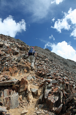 We went no more than 50 yards before the far off sound of thunder brought our forward progress to a halt and we returned to the saddle to start down to the truck. However, we chatted with the fellow from Connecticutt and after about 15 minutes, the distant skies had cleared to a good extent and there had been no more thunder. We conferred and with the continuing improvement of the skies, decided a fast climb of Wilson Peak mihgt be in the cards. We started off from the saddle and rather than droping down to the Cottoneer trail, we took a higher traverse of the sloping rock above the last remnants of a snowfield below. We had our axes but I was comfortable on the upper ledge section and as such we avoided the loss of elevation.
 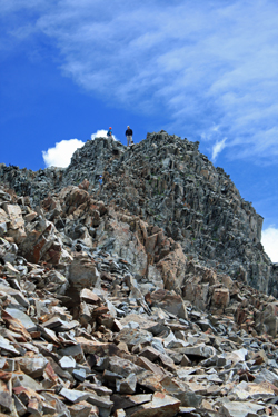 Once across the class 3 ledges, we joined the herd path that traverses along the flank of the peak, taking the opportunity to zig and zag along the way until we reached an obvous notch in the ridge about half way between the saddle and what appears to be the summit of the peak. One can however take a lesser traverse and avoid the climb to the notch and we took the lower and less ziggy course on our descent. From the notch we hiked the ridge for just a short distance before the trail again traversed the flank and after another ten minutes, deposited us at a class 2+ climb to what I recalled to be a false summit. There were a few folks coming down and a few standing on the false top, both groups having elected not to continue to the summit proper.
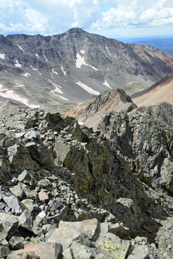 We exchanged greetings and then dropped our hiking poles so as to not have to carry them through the last class3 section that leads to the summit. The route dropped down perhaps 75 vertical feet, through solid hand and foot hold territory, before climbing back up about 150 feet through class 3 and 4 territory, the difficulty of which is left to the climber. We chose the more challenging route on the ridge proper, bringing the route to a light class 4 before arrivng as a short strectch of walking ridge and the summit proper. Standing atop Mount Wilson gave us our second summit of the day, Ed scoring one more 14'er and for me . . . another along the way to completing the top 100.
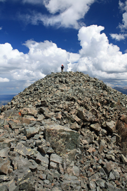 We spent a minute at the most on the summit before turning to make our way back down through the short technical section separating us from the false summit. We chose the gully side of the pitch for the descent for no more reason than variety. From there we had only to grab our poles and hoof the class 2 trail down the flank to the saddle below. We watched the other group tenuously cross the snowfield below our upper route to the saddle, without ice axes, but they all got through without an unexpected stop at the bottom. Once back at the saddle, we stopped for a snack and some talk to the other group before heading on down through the trail segments that lead through the large talus to the Rock of Ages saddle. From there is was just a 3.7 mile jaunt to the truck and a good dinner in Telluride before our traverse of the