|
||
|---|---|---|
Mount BuckskinOctober 17, 2009 - Ascent of NE Slopes & SE Ridge Descent
Given work commitments and an unusually cold and snowy stretch through later September and early October, I had not been climbing since my trip to the South Maroon Bell and Cathedral Peak, almost four weeks earlier. The weather forecast for Saturday promised a bluebird day and there was no way that I was not going to get in a day of climbing. While G and I do not normally do much climbing in the fall of the year, this year is different as prepping for a mid January trip to Argentina is the name of our game. The option of coasting along until there is enough snow for back country skiing is simply not an option this year.
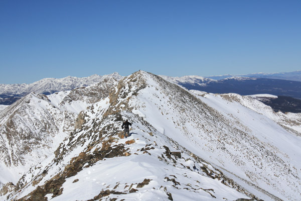
We were off and across the relative flats and aiming for the power line right of way as our first turning point, after which I figured we would cut left to a ridge that would most likely give us a talus hopping route to the summit ridge. The snow en route to the power poles ranged from a few inches to a foot, the deeper stuff piled up where the willows formed a natural snow fence. We made a relatively gentle ascent across and to a lower pole We arrived on the ridge and turned right to head for the first and higher Buckskin summit. The guide by Gerry Roach notes that the first summit is five feet higher than the second but it really did not matter as we were planning to tread across both for sure. The hike to the first summit took but a few undulating minutes of ridge walking and then we were off for the second summit, about a quarter mile distant. The terrain between the summits changes and the route takes on much more of a ridge walk with some class 2 terrain as compared to the almost smooth class 1 course to that point. We crossed over one shorter intermediate point and then climbed on up to the second summit proper. This second summit looks out onto the valley that rises from the hairpin turn on the Leadville side of Fremont Pass below the Climax Mine.
|

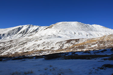 I suggested that we skip Rocky Mountain National Park or the Indian Peaks area in favor of someplace that we could park the truck and quickly gain elevation without an overly long approach. The peak that came to mind was Mount Buckskin, a peak that forms one flank of the valley that provides access to the standard routes on Mounts Bross, Cameron, Lincoln and Democrat. Buckskin promised a summit that neither of us had scored to date and the option of staying above 13,500 in the form of a long return along a ridge and across the summit of Loveland Peak or Mount Democrat.
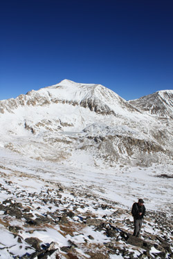 We met at my place in Cheyenne at 4:30 a.m. and headed south toward Fairplay via Hwy. 285. Our most important transportation consideration was staying off Interstate 70 on any day that promised any manner of good weather. I just did not want to spend the usual hour or more sitting in a snarl of slow moving traffic from Georgetown to the tunnels just beyond Idaho Springs. We made good time to Fairplay and Alma before taking the road to the Kite Lake trail head. Though the summits of the Mosquito Range peaks were obviously snow covered, the road to Kite lake was dry as a bone but for one or two small snow patches. We covered the six miles or so with little effort and parked in the lot at the Kite Lake trail head.
 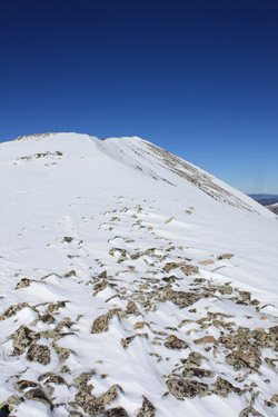 There were at least a dozen other vehicles already there at 7:30 and given the weather, there would surely be more to come. Our bets were that all were headed for 14k, which was good by us as we were not of similar mind. I took a few minutes to get the climbing duds on as I had suffered from a lack of motivation the night before and just tossed the climbing gear in the car to worry about the next morning. We looked at the slope and figured that the snow was mostly to be measured in inches rather than feet but we also knew there were some postholes to be made before we would see the summit. We did not have a solid climbing plan but for the goal to summit Buckskin and then decide whether to turn left and descend via the summit of Loveland Mountain or turn right and descend via the summit of Mount Democrat.
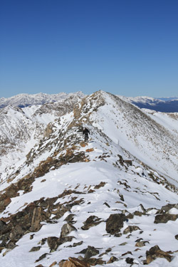 before cutting a diagonal path and kicking steps up a snowfield to a higher pole that marks the power line's zig toward the Buckskin/Democrat saddle and our departure to the south. We took some mellow ground in order to gain the easterly sub-ridge and then talus hopped upward for perhaps 500 feet of vertical before reaching the crest of the ridge connecting the summit of Loveland Mountain and Buckskin Peak's two summits.
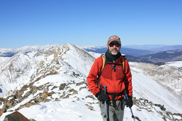 I'd first taken notice of Buckskin about five months before when Bob and I climbed
 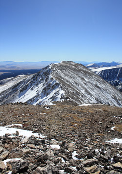 We retraced the ridge line to the first summit and then dropped down into the saddle connecting Loveland with Buckskin. The descent is gentle as is the subsequent climb toward the summit of Loveland Mountain that follows. The view from our easterly ascent ridge told a story of a steep scalloped ridge between Buckskin and Loveland but the view from the top gave away the fact that the western side of the ridge was more mellow and in fact had a substantial summer trail cut leading to the summit. We summitted Loveland and after another round of gorp and Cytomax, we were up and off toward the truck. We took the easiest route available, just dropping off the face of Loveland and heading down with a slight northerly drift toward Kite Lake. The snow was building on Loveland's northeast slope and given another storm or two, it will be a full fledged avalanche slope for the remainder of the winter. For the most of the descent, we did not sink in too deeply but we did see some knee deep patches here and there. Actually, we did not see these patches, we wallowed through them.
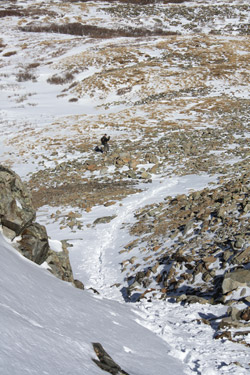 Near the base of the mountain, the terrain steepened markedly and we alternated hopping talus with wallowing through the snow that had drifted in a narrowing cleft. The cleft had all the makings of a classic terrain trap but for the fact that we were a one storm too early and there was no loaded slope above us to supply the snow. We dropped through the cleft and onto the more sedate terrain at the very base of the mountain. Now we needed only to cut a meandering course through the willows and then cross the creek before we could climb the short bank and hike the road back up to the Kite Lake parking area. We intercepted the road about 100 yards below the start of the hairpin turn and hoofed it up the road non stop until we were back at the truck. All told, about a five mile round trip and I'd guess about 3000 feet of vertical. Not a hard day by any means but a great day out in some of the best fall weather one could ask for.