|
||||||||||||||||||||||
|---|---|---|---|---|---|---|---|---|---|---|---|---|---|---|---|---|---|---|---|---|---|---|
Banff Assiniboine Expedition IAugust 10, 2002 – Rain, Snow and Success on Mount Hector
Mount Hector would be our third climb but the weather was not looking to cooperate as it had for Athabasca. We agreed that if it were raining (the forecast) at 3 a.m., we would sleep in until 4 and so on until 6 a.m. Rain at 6 would be the death knell for the climb. The alarm went off at 3 and I looked to the sky for cloud or stars and was met with half and half. Jim and I left Chateau Gravel Pit and picked Gary up at the RV for the 20 km. ride to the Hector Creek trailhead.
The ranger at the lake Louise visitor’s center had provided some additional beta on the climb, specifically that the snow should be in decent shape on the glacier and that the climb would take a “full” day. We were finally coming to believe that the alpine start and early afternoon finish of Colorado climbing might not exist in this part of the Rockies. The route called for us to find a climbers trail on the south side of Hector Creek, go up to a waterfall with a class 4 climb around to one side, gain the top of the headwall and then a meander up the steadily rising valley to the toe of the glacier. The summit was to be in sight from the moment we stepped foot on the glacier and overall, Hector was not supposed to be too hard a climb. It proved to be a good climb and a measuring post with which to gauge the progress we had made over the first two ascents of the trip.
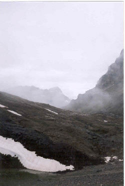
We parked the truck and found the climber’s trail along the creek without a problem but those stars I told of earlier, well . . . they were pretty much gone by this point, replaced by steadily descending clouds, now obscuring nearby peaks visible on the drive up. The clouds soon did what clouds are supposed to do . . . produce a steady rain, necessitating the donning of Gore-tex outer layers for the now wet approach to the class 4 climb needed to skirt the waterfall. The rock climb came just after dawn and with some debate, we located a viable route to the climber’s left that switched to the opposite bank of the creek just above the crest of the falls. Mud, wet brush and a cold rain appeared to be the order of the day.
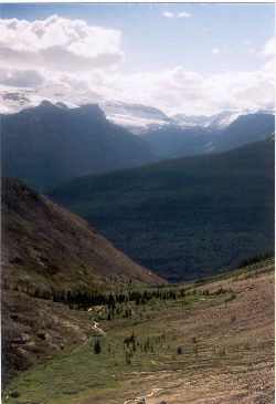
Above the falls, the trail steadily climbs along moraine remnants and up short headwalls for an endless distance. We had already come to respect the effect of switching from the 1:24,000 topos we have in the States to the Canadian scale of 1:50,000 but this approach was endless, especially near the upper reaches where one turns to the right and climbs a series of terminal moraines like hurdles lined up on a track. Finally, we reached the toe of the glacier and still we have not seen the summit of the peak. We know where it is, what direction to go, but the clouds are simply not going to rise to give us a confirmed sighting. However, the rain has quit and we are starting to see patches of blue sky in increasing proportion to the cloud deck, which fortunately was also lifting bit by bit. There was promise of a good day and we were going to take our best shot at this summit (yes, we did bring a supply of wands)
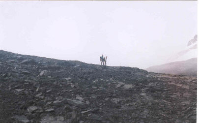
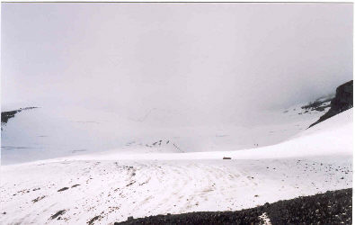
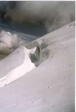
The glacier gear went on and we followed the fresh trail of a 2-person team about ½ hour ahead of us. The snow on the lower glacier was mush but as we climbed, it began to firm up, giving us good thoughts about crossing the crevasses that two rangers had already told us to be wary of on the standard route. The glacier is gently sloped for most of the distance however, the final ¼ of the climb is a steep ascent to a rocky knob of a summit. The crevasses were obvious and the snow bridges firm enough to cross, however most had a peephole or two that reminded us of the care required for this type of travel.
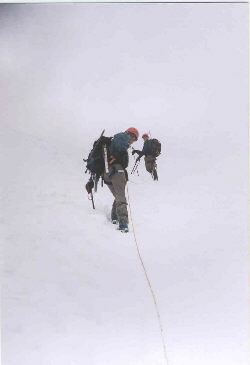
By the time we reached the steeper climb, we were breaking trail through 6 inches of fresh snow, which the wind was moving about enough to almost cover the trail of the two climbers ahead of us. We stabbed wands at turning points and continued making steady progress, switchbacking upward toward the bergshrund. The footing underneath also changed as we now felt our crampons biting into hard ice as we took a back and forth course for perhaps the final quarter mile leading to the base of the knob. We also leapfrogged between leader and sweep due to the tiring effect of breaking trail through the fresh snow.
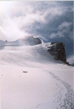
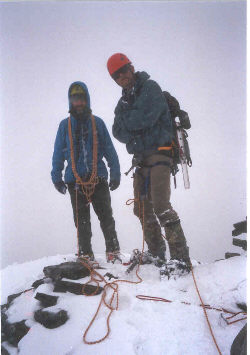
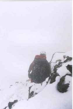
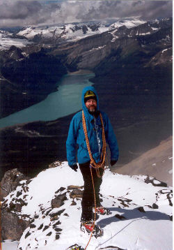
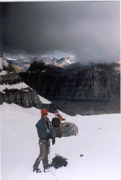
The weather was playing games with us, we had spotted the summit and knew where we where going but the final act was going to be a cold event. Jim’s goggles were fogging over with every passing burst of cloud and then clearing with each spot of sunlight. We were now just below the summit rock pitches, within just a few hundred feet of the top, and stopping to determine if we could go on with a virtually blind middle climber. Hector teased us a bit more with a sunny interval, allowing us to ascend the rock to the summit proper. The other two climbers had waited for our arrival, wished us good luck in our descent, and thanked us for a trail back down the fresh snow blanketing the upper reaches of the glacier. Concurrently, the band of dark clouds that threatened our semi sunny final pitch came in with a vengeance, plunging us back into winter-like cold wind and blowing snow. Would it clear again or not? We were not interested in waiting any longer to find out than it would take to sip some water, shoot a goo, and set up a belay to lower the middle and sweep climbers back down the slippery rock to the top of the glacier below.
Fortunately, we did get a sunny interval, snapped a half dozen photos and then watched the next squall descend upon the summit. Jim and Gary made belayed descents for two rope lengths to the snow, belaying me in turn, as I brought up the rear. Once back on the glacier, Gary picked his way across the bergshrund and on down the steeper sections, retrieving wands along the way. Once we hit the flatter portion of the glacier, we were below the breaking cloud deck and could see all the way to the toe of the glacier and the moraines beyond. We stepped off the toe of the Hector Glacier, snacked and packed the ice gear for the long walk back down the valley. The rain continued to threaten but held off long enough for us make the multi-mile descent and waterfall downclimb in a reasonably dry and comfortable state.
The Mount Hector climb was a full day, taking 14 hours to cover a “guidebook distance” something over 7 miles roundtrip. The remainder of the trip would be consumed by one peak, Mount Assiniboine, necessitating that we camp well to the south in Canmore. This would also be the last climb for Jim as his plans were split between our cold weather climbing event and a second week in the tropics, no doubt trying to elevate his core temperature after Mount Hector and more than a few nights in the tent. We headed south and the four of us enjoyed a mid trip farewell dinner with Jim before heading for the tent and RV, well after 11 in the evening.
Saturday was a long day for sure but a viable rope team was coming together and the three of us had learned more than a little bit about alpine climbing during our efforts on the last three peaks. Assiniboine would prove to test those skills . . .
|
