-
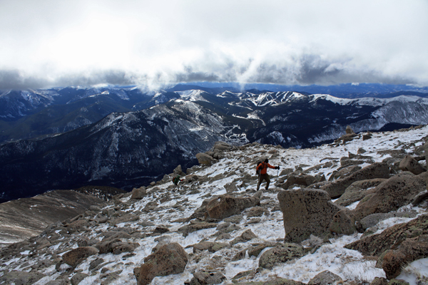
Mt. Bierstadt Group Summit - Front Range, Colorado
-
A rest before the summit push on Dallas Peak - San Juan Range, Colorado
-
Broken Ankle + 6 Miles = Tired
-
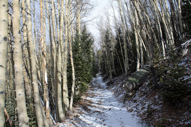
The classic San Juan approach - San Juan Range, Colorado
-
Overlooking Noname Basin from Twin Thumbs Pass - San Juan Range, Colorado
-
Upper Noname Basin - San Juan Range, Colorado
-
Nearing Noname Cabin - San Juan Range, Colorado
-
Twin Thumbs Twins - San Juan Range, Colorado
-
Nearing the summit of Pt. 13,736 - Sawatch Range, Colorado
-
Blustery day on Iowa Peak - Sawatch Range, Colorado
-
Morning snow at 15k, Cerro Ramada - Cordillera Ramada
-
Artesonraju from the summit of Nevado Pisco - Cordillera Blanca, Peru
-
February crowds on Gray's Peak - Front Range, Colorado
-
Kicking steps on Cerro Lliani - Cordillera Vilcanota, Peru
-
Final traverse to the summit of Wheeler Mountain - Ten Mile Range, Colorado
-
The long walk to Pachanta - Cordillera Vilcanota, Peru
- banner31
Afternoon at 17k on Cerro Ramada - Cordillera Ramada, Argentina
- banner22
The final ridge on Iowa Peak - Sawatch Range, Colorado
-
Summer summit on Longs Peak - Front Range, Colorado
-
A rest day at the Pachanta Hot Springs - Cordillera Vilcanota, Peru
-
Mind over matter on Mt. Parnassas - Front Range, Colorado
-
Rest stop on Cerro Lliani - Cordillera Vilcanota, Peru
- banner30
Post nap surprise on Cerro Ramada - Cordiller Ramada, Argentina
-
Summit on Cerro Lliani - Cordillera Vilcanota, Peru
- banner23
Ridge walking on Grizzly Peak - Sawatch Range, Colorado
-
Enroute the summit via the West Ridge on Pacific Peak - Ten Mile Range, Colorado
-
Mule train bound for Chilca - Cordillera Vilcanota, Peru
-
Taking in the view from Fletcher Peak - Ten Mile Range, Colorado
-
Hiking on Silverheels - Mosquito Range, Colorado
-
Traversing! Gladstone Peak - San Juan Range, Colorado
- banner24
The best of times at Willow Lake - Sangre de Christo Range, Colorado
- banner29
High Altitude Cerebral Edema? - Cordillera Ramada, Argentina
-
Bound for Chilca - Vilcanota Range, Peru
-
Going alpine light, Holy Cross Ridge - Sawatch Range, Colorado
-
Cumbre! Campa I - Cordillera Vilcanota, Peru
-
Roadside lunch with the best of company - Cordillera Vilcanota, Peru
- banner25
Long ridge walk to the summit of California Peak - Sangre de Christo Range, Colorado
- banner28
Crossing el Rio Colorado . . . in the afternoon - Cordillera Ramada, Argentina
- banner37
Dealing with Fall snows high on Casco Peak - Sawatch Range, Colorado
-
Moonrise over Mercedario - Cordillera Ramada, Argentina
-
Still climbing at 20,900 on Cerro Ramada - Cordiller Ramada, Argentina
-
Talus on Halo Ridge, Mt. of the Holy Cross - Sawatch Range, Colorado
- banner26
Deteriorating conditions on Mt. Arkansas - Ten Mile Range, Colorado
- banner27
After the climb - Cordillera Ramada, Argentina
- banner38
Taking in the view from the summit of Crystal Peak - Tenmile Range, Colorado
-
Topping out on Mt. Arkansas' North Couloir - Mosquito Range, Colorado
-
Glissade on Mt. Arkansas - Mosquito Range, Colorado
-
Hard snow morning on Teakettle Mountain - San Juan Range, Colorado
-
Spring snow announces the start of the climb on Dallas Peak - San Juan Range, Colorado
-
Crossing the Eolus Catwalk - San Juan Range, Colorado

 Lomo saltado the night before in Denver slowed our trip to Salida but I'd given the innkeeper notice of our anticipated late arrival and found an envelope with my name taped to the front door of the Super 8's office. We had a room and a quick breakfast the next morning before heading to the parking area across from the Monarch Lodge, from which we would start our anticipated twofer hike of Taylor Mountain and Mount Aetna. We knew that the first mile or so would be on an old road, which turned out to be one steep old road that led up through the woods, past a small fenced grave and more steeply up the southern flank of Kangaroo Gulch.
 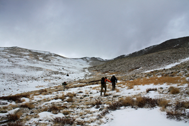 The trail had a bit of snow and the tracks of at least one fellow who had left just a few minutes before we did. We arrived at the hard left turn and stopped as this was our first real exposure to the wind that was forecast to be 15 to 20 mph with gusts to 35 or 40. The wind was exactly as forecast and after but a moment of hesitation, the balaclava and wool caps came out of the packs and onto the heads. With hoods up and the wind buffeting us from behind, we left the road and wended up through a few remaining trees into the gully that forms upper Kangaroo Gulch. The gully was filled with enough snow that we could hike, "thinking light" of course, up the center except for the few spots where the snow was fragile.
 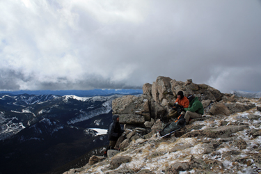 The wind was relentless at the bottom but subsided a bit further up and came in bursts but it seemed that there were breaks in the clouds coordinated with the worst of the wind to offset the cold with a bit of sunshine. We continued upward, picking grassier paths and taking but one break before we hit the steeper talus and boulders that guarded our approach to the ridge crest. Once past the large boulders we were on the ridge proper and taking our second break of the day. The summit appeared to be just a few minutes away but after climbing another 75 feet or so of vertical, we topped a false summit with the real thing but a few more minutes ahead.
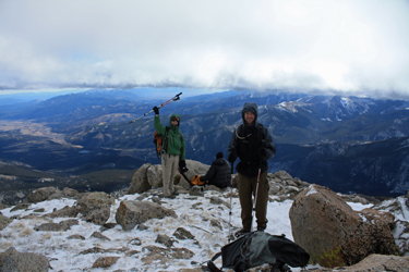 We climbed on and topped out on the summit of Taylor Mountain, at an elevation that seemed to be about 100 feet below the base of the clouds sliding across the lower Sawatch. No doubt we were in the ground effect but still close enough to add a layer of down and minimize our time on the summit. The goal had been to climb Aetna as well, but given more than a few cold fingers and toes, we opted to descend and leave Aetna for another day, given that the wind would be in our face the whole way across. However, extra points went to a group of three who were halfway across, having tracked the summit of Taylor no more than an hour before our arrival.
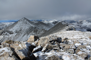 Our route down was the SW ridge proper, all the way down to the start of the trees. Then we had a choice, drop left to descend on the route we elected not to hike up that morning . . . or drop right to the spot on the road where we earlier put on extra layers for a shorter, non swithcbacking route to the car. We opted for the short known route and descended a talus slope from hell. Nothing big but much of it loose enough to make the footing difficult from the start to the road far below. We ended up avoiding the direct drop for individual traverses back up-gulch to intercept the gully bottom snow line.