-
Mt. Bierstadt Group Summit - Front Range, Colorado
-
A rest before the summit push on Dallas Peak - San Juan Range, Colorado
-
Broken Ankle + 6 Miles = Tired
-
The classic San Juan approach - San Juan Range, Colorado
-
Overlooking Noname Basin from Twin Thumbs Pass - San Juan Range, Colorado
-
Upper Noname Basin - San Juan Range, Colorado
-
Nearing Noname Cabin - San Juan Range, Colorado
-
Twin Thumbs Twins - San Juan Range, Colorado
-
Nearing the summit of Pt. 13,736 - Sawatch Range, Colorado
-
Blustery day on Iowa Peak - Sawatch Range, Colorado
-
Morning snow at 15k, Cerro Ramada - Cordillera Ramada
-
Artesonraju from the summit of Nevado Pisco - Cordillera Blanca, Peru
-
February crowds on Gray's Peak - Front Range, Colorado
-
Kicking steps on Cerro Lliani - Cordillera Vilcanota, Peru
-
Final traverse to the summit of Wheeler Mountain - Ten Mile Range, Colorado
-
The long walk to Pachanta - Cordillera Vilcanota, Peru
- banner31
Afternoon at 17k on Cerro Ramada - Cordillera Ramada, Argentina
- banner22
The final ridge on Iowa Peak - Sawatch Range, Colorado
-
Summer summit on Longs Peak - Front Range, Colorado
-
A rest day at the Pachanta Hot Springs - Cordillera Vilcanota, Peru
-
Mind over matter on Mt. Parnassas - Front Range, Colorado
-
Rest stop on Cerro Lliani - Cordillera Vilcanota, Peru
- banner30
Post nap surprise on Cerro Ramada - Cordiller Ramada, Argentina
-
Summit on Cerro Lliani - Cordillera Vilcanota, Peru
- banner23
Ridge walking on Grizzly Peak - Sawatch Range, Colorado
-
Enroute the summit via the West Ridge on Pacific Peak - Ten Mile Range, Colorado
-
Mule train bound for Chilca - Cordillera Vilcanota, Peru
-
Taking in the view from Fletcher Peak - Ten Mile Range, Colorado
-
Hiking on Silverheels - Mosquito Range, Colorado
-
Traversing! Gladstone Peak - San Juan Range, Colorado
- banner24
The best of times at Willow Lake - Sangre de Christo Range, Colorado
- banner29
High Altitude Cerebral Edema? - Cordillera Ramada, Argentina
-
Bound for Chilca - Vilcanota Range, Peru
-
Going alpine light, Holy Cross Ridge - Sawatch Range, Colorado
-
Cumbre! Campa I - Cordillera Vilcanota, Peru
-
Roadside lunch with the best of company - Cordillera Vilcanota, Peru
- banner25
Long ridge walk to the summit of California Peak - Sangre de Christo Range, Colorado
- banner28
Crossing el Rio Colorado . . . in the afternoon - Cordillera Ramada, Argentina
- banner37
Dealing with Fall snows high on Casco Peak - Sawatch Range, Colorado
-
Moonrise over Mercedario - Cordillera Ramada, Argentina
-
Still climbing at 20,900 on Cerro Ramada - Cordiller Ramada, Argentina
-
Talus on Halo Ridge, Mt. of the Holy Cross - Sawatch Range, Colorado
- banner26
Deteriorating conditions on Mt. Arkansas - Ten Mile Range, Colorado
- banner27
After the climb - Cordillera Ramada, Argentina
- banner38
Taking in the view from the summit of Crystal Peak - Tenmile Range, Colorado
-
Topping out on Mt. Arkansas' North Couloir - Mosquito Range, Colorado
-
Glissade on Mt. Arkansas - Mosquito Range, Colorado
-
Hard snow morning on Teakettle Mountain - San Juan Range, Colorado
-
Spring snow announces the start of the climb on Dallas Peak - San Juan Range, Colorado
-
Crossing the Eolus Catwalk - San Juan Range, Colorado

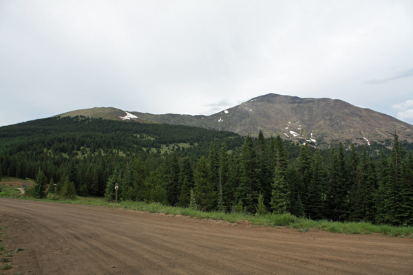
 I'm a devotee of the alpine start but relented due to the shorter nature of this climb, hence I set the alarm for 5:30 and was on the trail by 6 a.m. I'd read the guide's description about starting at the cabin near the road and heading up through the "open" forest for the tree line or the alternative of taking the four wheel drive road that constitutes the Colorado/ Continental Divide Trail for a bit over a mile, after which the cut up through the tree to open ground would be shorter. I opted for more road and less forest navigation . . . so up the 4WD road I hiked.
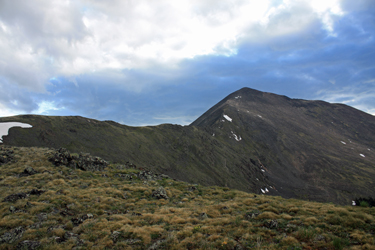 The road leads to an excavation on the right side after a bit over a mile and right before that obvious rock cut, I noted a 4WD track heading directly up hill. It may or may not have been tree line bound but I took its up angle as a good start. The road quickly degraded to a trail with a strong pattern of stone cairns, many more than really needed by anyone with a smidgeon of self confidence. However, the strong "cairnage" of the route, gave me the confidence to follow it and sure enough, it did lead to tree line.
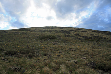
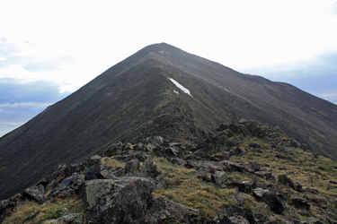 I broke tree line and headed directly uphill, knowing that the skyline would be a point on the ridge line that could be followed north to the ridge that leads to the summit ridge. Sure enough, I broke the ridge about one quarter mile south of the west ridge to which I traversed directly. The west ridge offered a level run for a bit, then a bit of up and down before coming to the last "down" cleft before it climbs about 1500 feet to the summit. The course from the juncture with the north/south ridge to the the last dip was mixed class 1 and some class 2, here and there. I dropped into the mid ridge dip and looked upward . .. 1500 feet of vertical to go.
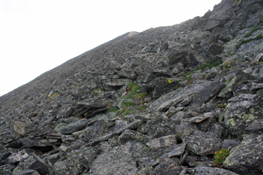 The climb up the ridge to the summit was mostly class 2 and for some reason I slipped off onto the northern flank of the ridge, but still I seemed to be connecting trail segments for the majority of the route. The most obvious bench mark is a large quartz outcropping about 2/3 of the way up, which I bypassed to the left side. From there it was up and over lots and lots of talus before the final summit hump, where the incline lessened and yielded more or less a walk to the summit with trail segments up through the remaining talus. Soon enough I was standing at the large summit rock mound, to which I added a small stone and gummy bear . . . Pachamama had granted me a 3 hour warmish ascent to the summit and I wished for a speedy and safe return to the truck.
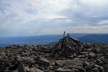 The trip down was more ridge oriented and there was a strong climber's trail on the ridge proper for most all of the descent. I stuck to the ridge top, and after climbing the short rise up from the mid ridge cleft, I passed a group heading for the summit. I continued on, passing another couple of climbers at the ridge juncture, before I traversed south to my original break point. I dropped back to the tree line, intercepting my selected way point, a 15 foot pine snag that marked the exact entry to the woods and the trail leading back to the 4WD road. The road provided an easy hike back to the truck and 2 hours after leaving the summit, I was back at the truck and steeling myself to fight the traffic back to Denver and on to Cheyenne.